General Maps
Overview map
Physical map
Thematic maps
     
News
General maps
Regional maps
Transport maps
Links
Polls
Site map
Behind the maps
Regional Maps
Norvag maps
Scansey maps
Tronlad maps
Garand maps
   
Transport Maps
Railway maps
Autoroute maps
Water maps
Air maps


 You are here:Home / Behind the maps / About
 
   About Norscand Geofiction Maps Site   Current Poll
       
       Which map to be next?  


Many people like maps. Some of them have seen a lot of maps of our world and they want more. So, this site is to present maps of other worlds for all who like maps of imaginary places.


Norscand Geofiction is a hobby website for personal entertainment. Tell me what other maps you would like to see by e-mail info2 at norscand . net


 FAQ and answers from Norscand guy

1.Who is behind the Norscand Geofiction website?

Look left. It’s me – Andy. I have to do my exercise to be in shape after sitting in front of my PC.


Except drawing I like travelling, so I also spend much time for preaparing my upcoming trip.


2.Why maps of imaginary places?


I don’t know exactly why. I could tell you about the theoretical basis of it, but, actually, it matters nothing. I guess it’s a question of personal taste and individual preferences.


I just can tell about some positive merits that the hobby of drawing this kind of maps brings into your life. It’s planning, aiming, strategy, tactics, details, creativity, integrity and much more. It’s absolutely helping in solving your tasks in ordinary life. The only thing for using it is to be fond of maps.

Baltic shore inspires me much.

3. Much time is needed to create such maps, isn’t it?


When you’re new in this activity, indeed, you’ve got to have much time. If you never took a pencil or computer mouse, if you don’t know how to start, yes, the creation of the first map can consume three months or even more. But skills come with experience.


Imagine, you go for your studies or work every day. Every day you do almost the same things. So, after a certain time, these maps are ordinary things for their creator. But besides the time of drawing, creativity and imagination takes its time too for thinking of idea and map details.

Sabbatical.


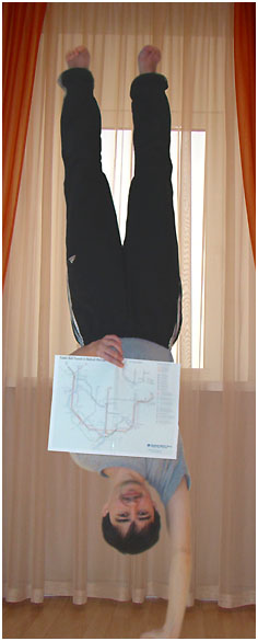
I started drawing maps when I was 6 and this passion hasn’t gone as my natives supposed. Rare map presented on this website was needed more than 40 working hours. In most cases 10 hours are enough for an urban area and 5 hours for transit plans. If you divide these hours by 7 days, you can calculate that 1-2 daily hours are enough - supposing that I draw one urban or transit map per week. Calculate the time you spend daily on the web or TV watching. I guess it’s much more than I spend for drawing.


Some people say that I have no life because of my website. I’m an ordinary family guy, with everyday work from 9 am till 18 pm or more, daily problems and questions. My hobby goes as background that slightly has got an influence on my family life.


Of course, I don’t draw maps everyday; I do it by desire and opportunity. I guess, any other hobby has got a particular number of merits, so to be addicted to it is worthy anyway.
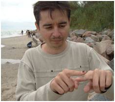
Young generation makes first steps in map drawing


4.How can I draw such maps?


At first, make a sketch by hand and then scan it into a drawing software. It’s more easily to figure out all the things by pencil on paper then process it in a computer. Take your favorite map as a sample and repeat its style.


You can learn in numerous tutorials how to draw in appropriate program. You can find such manuals on the internet. Inkscape is an accessible vector freeware (www.inkscape.org) to start drawing, but Adobe Illustrator or Corel Draw are more functional.


Drawing maps is easy! After the third one you will be able to do it with closed eyes with speed of sound :). As for details, there’s a plan to write an essay about the creation of geofiction maps later. Feel free to send any comments and questions to info2 at norscand . net


5. When will new maps be available on the website?


Currently I'm involved into Opengeofiction cartographic project, so there's no time for Norscand Geofiction


Back to the "Behind the maps" section


1.Arandam city centre.


Features: High-Rises - yes, Relief - flat, Pedestrian network - probably yes, Medieval or historic parts core - no, Population of area - 1.160.000

2.Aristan city centre.


Features: High-Rises - yes, Relief - flat, Pedestrian network - small, Medieval or historic parts core - small, Population of area - 370.000

3.Lort city centre.


Features: High-Rises - yes, Relief - flat, Pedestrian network - probably yes, Medieval or historic parts core - no, Population of area - 800.000

4.Swengai city centre


Features: High-Rises - yes, Relief - flat, Pedestrian network - probably yes, Medieval or historic parts core - yes, Population of area - 1.170.000

5.Dolton city centre


Features: High-Rises - yes, Relief - flat, Pedestrian network - probably yes, Medieval or historic parts core - probably yes, Population of area - 440.000

6.Frensax city centre


Features: High-Rises - yes, Relief - flat, Pedestrian network - probably yes, Medieval or historic parts core - yes, Population of area - 530.000

7.Gros city centre


Features: High-Rises - yes, Relief - hilly, Pedestrian network - probably yes, Medieval or historic parts core - yes, Population of area - 860.000

8.Jansen city centre


Features: High-Rises - yes, Relief - hilly, Pedestrian network - probably yes, Medieval or historic parts core - small, Population of area - 1.500.000

9.Lonsen city centre


Features: High-Rises - yes, Relief - flat, Pedestrian network - probably yes, Medieval or historic parts core - yes, Population of area - 320.000

10.Trassen city centre


Features: High-Rises - yes, Relief - flat, Pedestrian network - probably yes, Medieval or historic parts core - yes, Population of area - 430.000

11.Tronlax city centre


Features: High-Rises - yes, Relief - hilly, Pedestrian network - probably yes, Medieval or historic parts core - yes, Population of area - 540.000

5th PLACE
Map is being drawn! Choose next city

12.Pentlan city centre


Features: High-Rises - yes, Relief - flat, Pedestrian network - probably yes, Medieval or historic parts core - yes, Population of area - 970.000


4th PLACE
Map is ready! Choose next city

13.Scanseik city centre.


Features: High-Rises - yes, Relief - hilly, Pedestrian network - yes, Medieval or historic parts core - yes, Population of area - 400.000


3rd PLACE
Map is ready! Choose next city

14.Grenlinn city centre.


Features: High-Rises - yes, Relief - hilly, Pedestrian network - yes, Medieval or historic parts core - yes, Population of area - 1.250.000


2nd PLACE!
Map is ready! Choose next city

15.Walden city centre


Features: High-Rises - yes, Relief - hilly, Pedestrian network - probably yes, Medieval or historic parts core - yes, Population of area - 1.060.000


1st PLACE!
Map is ready! Choose next city

16.Yogo city centre


Features: High-Rises - yes, Relief - flat, Pedestrian network - yes, Medieval or historic parts core - yes, Population of area - 590.000

Results          Poll archive


  © 2007-2018 Norscand Geofiction Maps  free counters