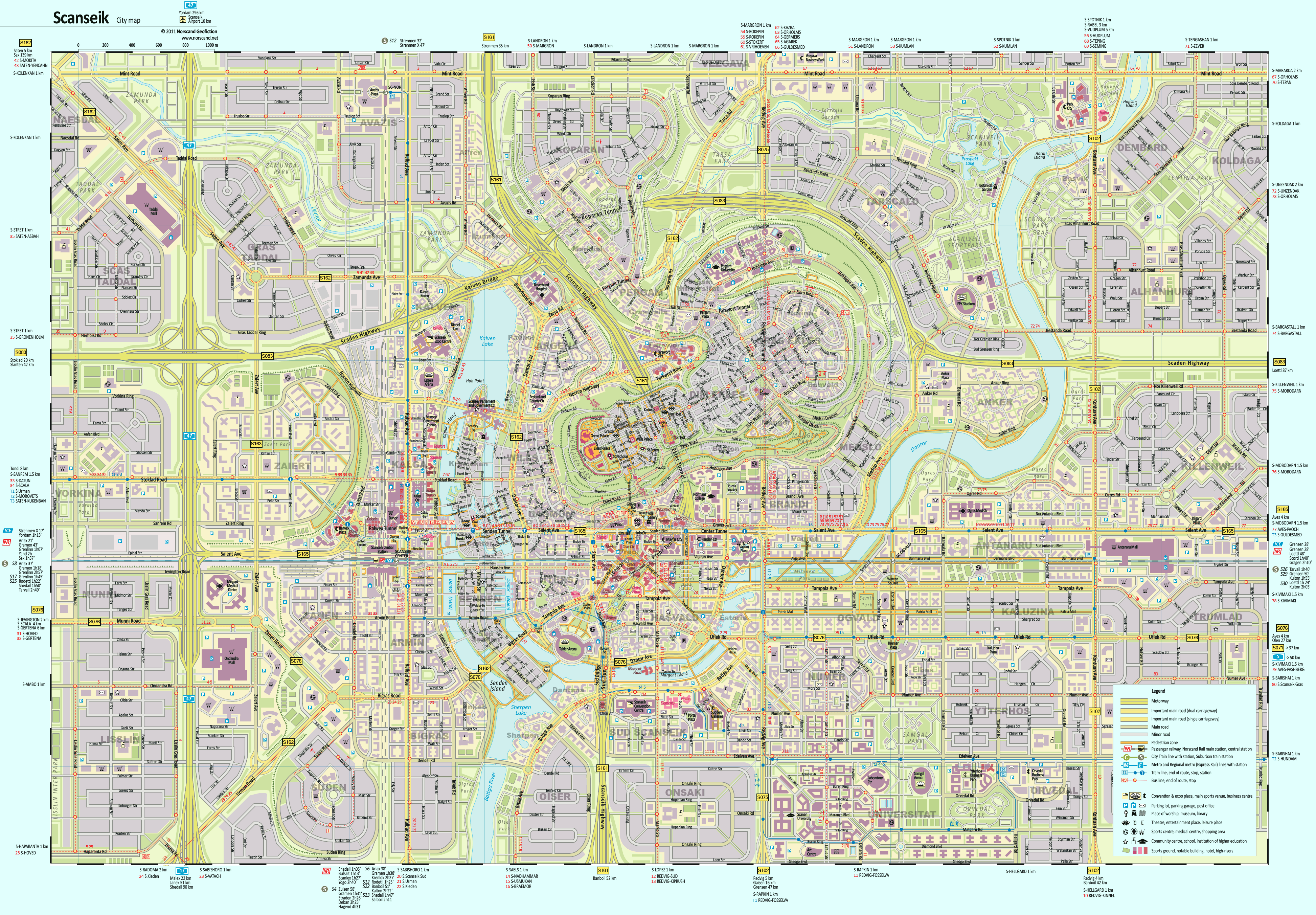
Scanseik is the capital of Scansey, one of the four Regions of Norscand. Despite its relatively small size in terms of population, only 400.000 in metro area, the city is important administrative, scientific and commercial centre of the country. It was formed by amalgamation of two places Scanden (located in hilly part, now Ekles district) and Seiklax (Senden district). Due to its rich historical and architectural heritage the city also is the main tourist destination.
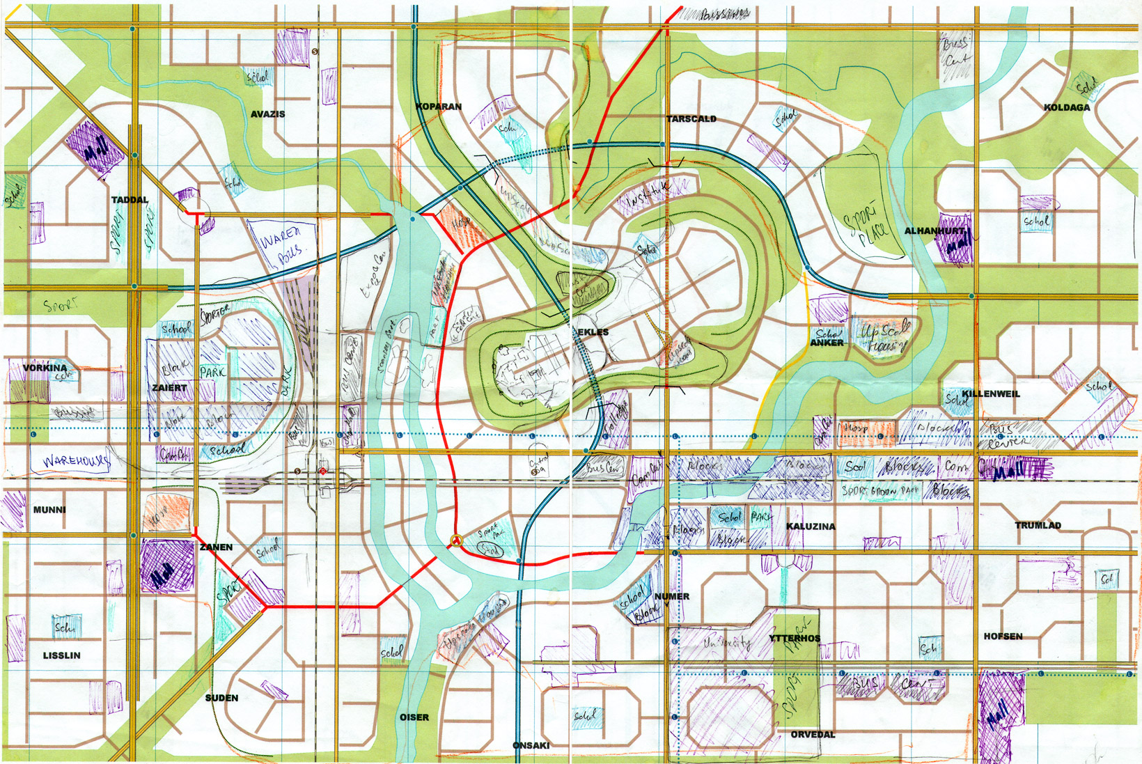
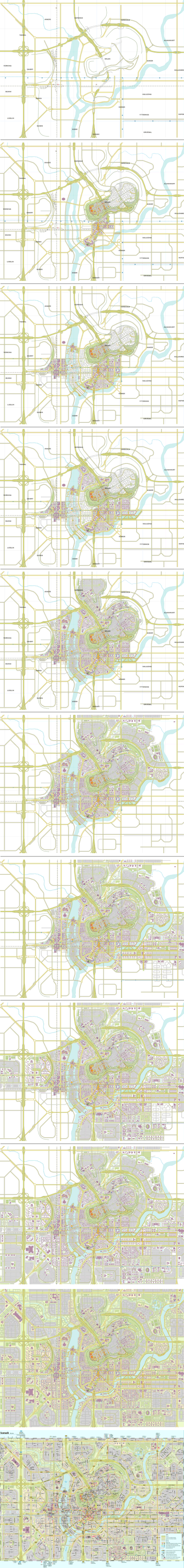
Drawing map of Scanseik was intrigued task for me. Interesting relief and developed infrastructure gave a good meal for my imagination. The entire map was done during 29 working days. The short video below and drawings on the right show how work was progressed. Before the beginning new map I make a sketch to lay the zoning areas and main large scale city objects out. This kind of sketch for Scanseik map is shown below.
Several figures about map number of unrepeatable map objects is about 9100, including 3170 for buildings, 2500 for roads and walkways, 1240 for labels, 425 for public transit stops, 330 for sports venues. The length of depicted driveways is 970 km.
Sketch with the principal urban zones and objects before starting drawing map.
Scanseik City Map- defining zones (1640x1097 pix, 0.8 Mb)
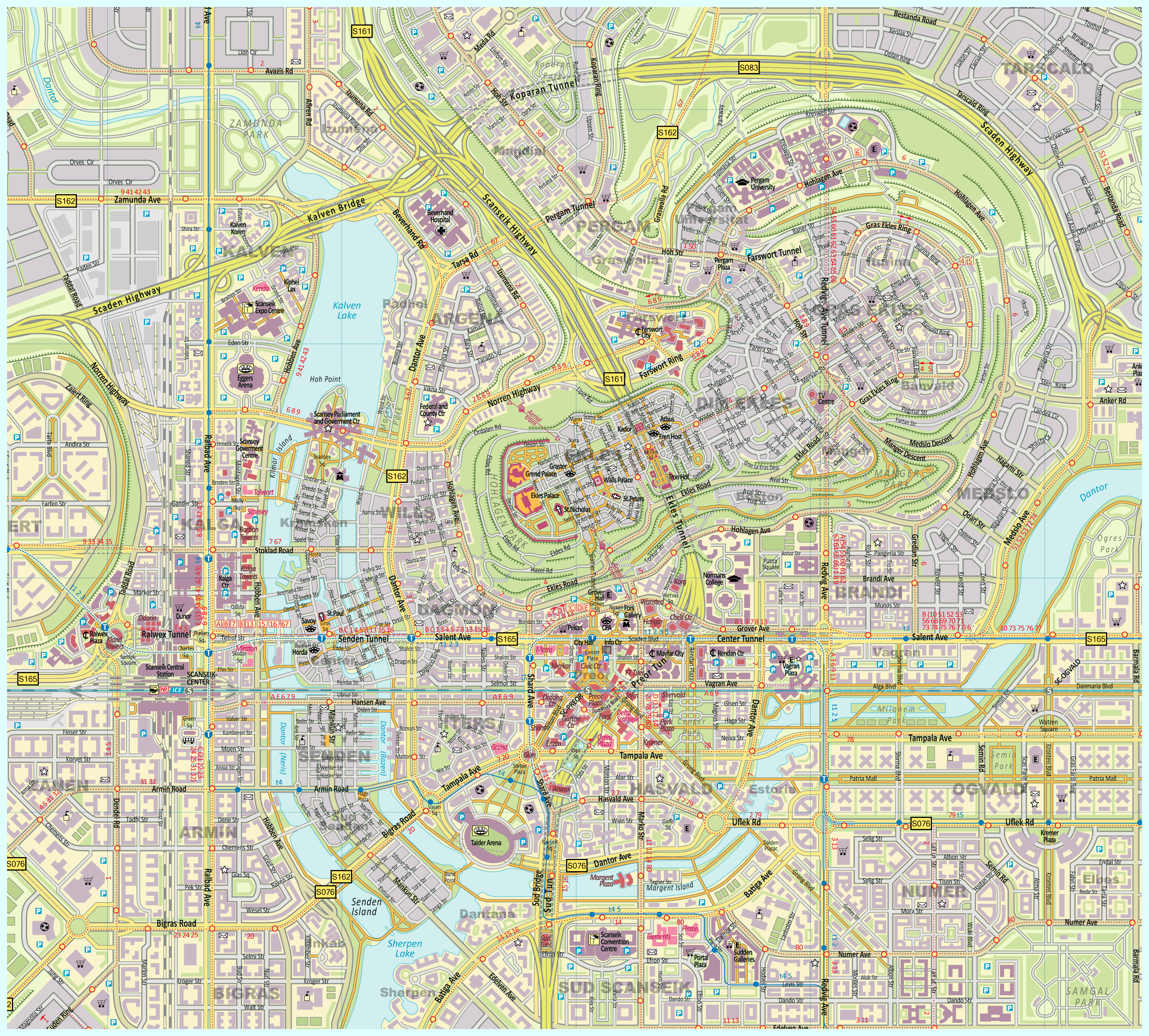
Central part of the map in size of double scale for closer look.
Scanseik City Map- double sized scale (4085x3686 pix, 2 Mb)
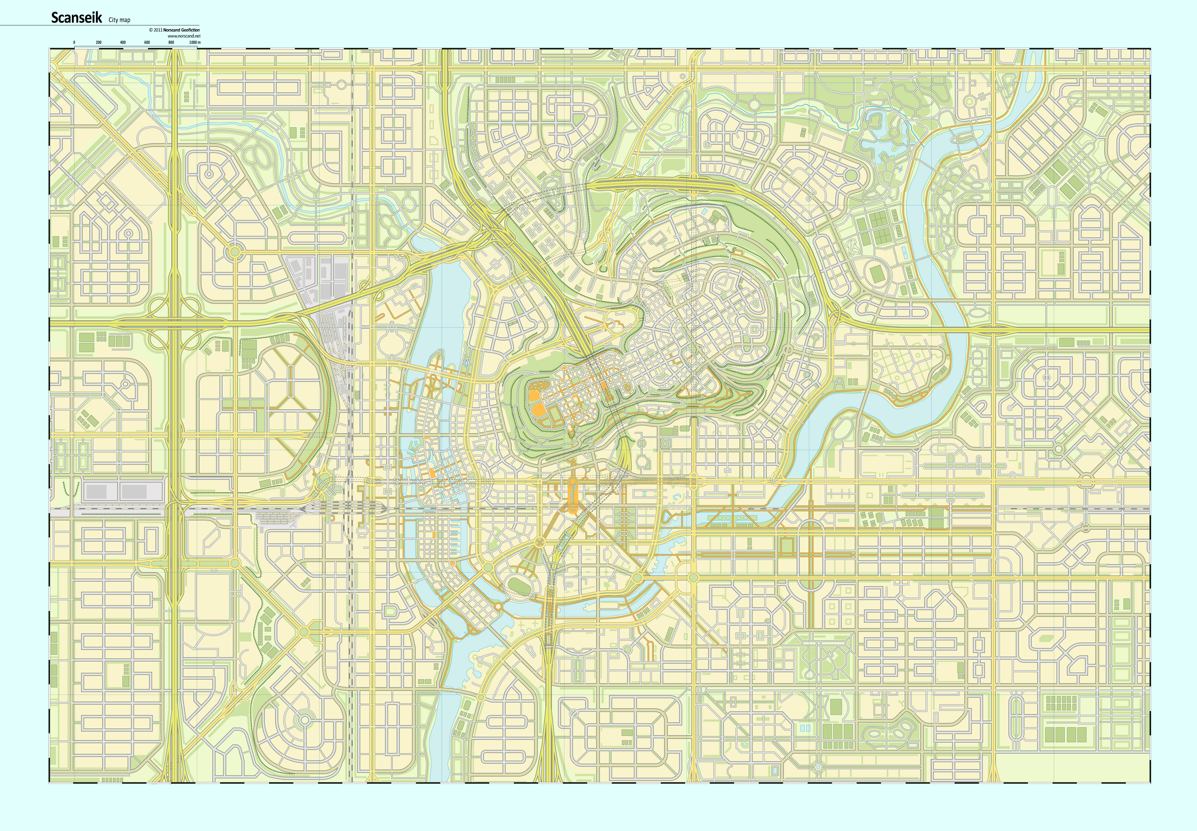
Road network without unnecessary details
Scanseik City Map- roads (3911x2716 pix, 0.9 Mb)
Map with public transit (bus, tram)
Scanseik City Map - public transit (3911x2716 pix, 0.5 Mb)