| |
|
|
| Flag |
Coat of Arms |
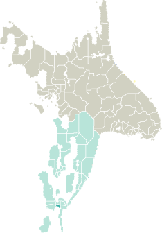
Location |
 |
 |
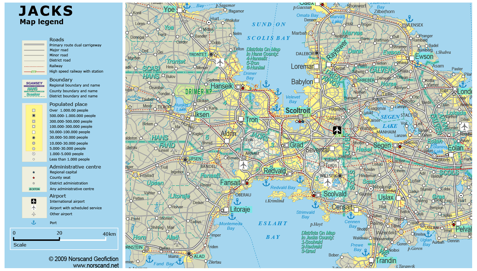
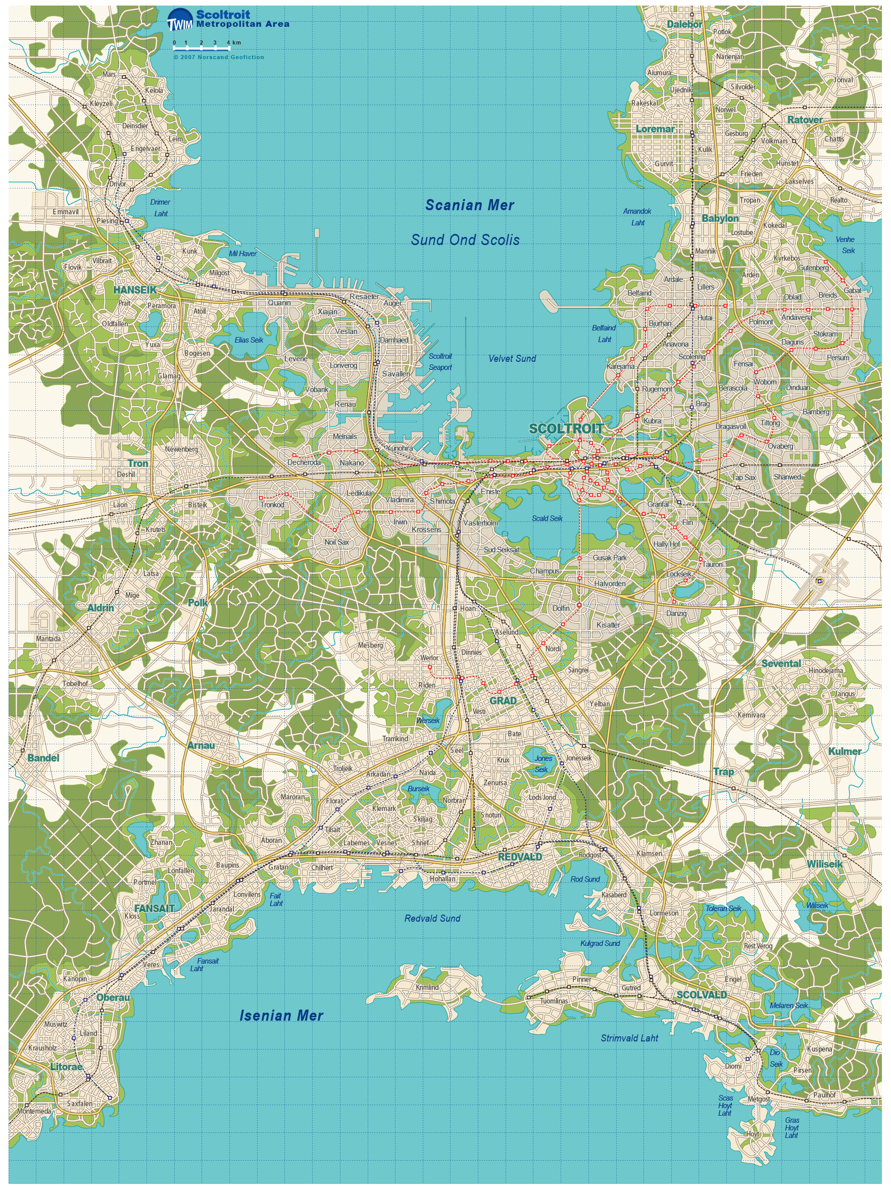
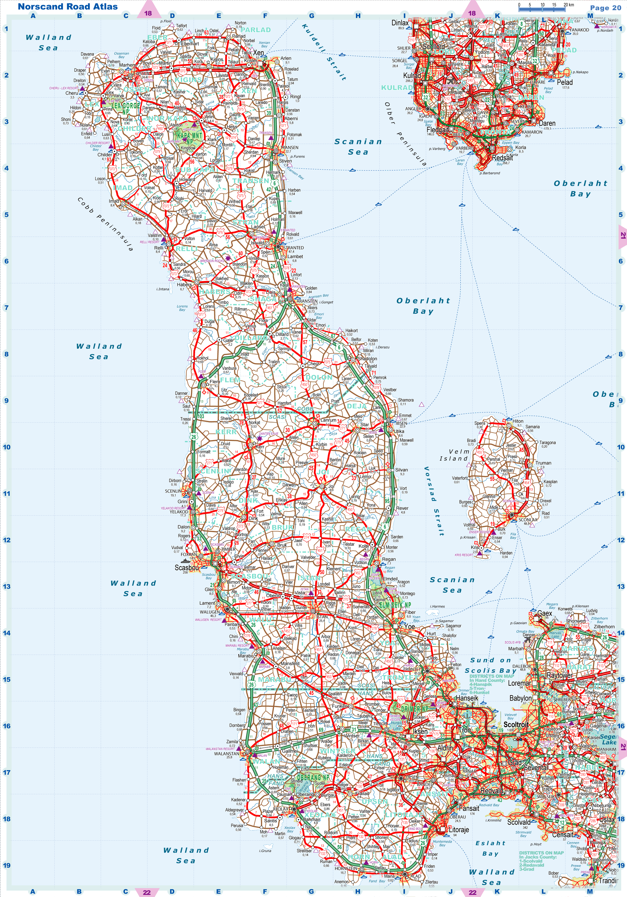
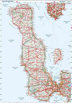
| Road maps for this area |
 |
|
| |
|
| Location |
Southern Garand |
| Area |
 Continental Continental |
869 sq.km |
| Isles |
14 sq.km |
| Water bodies |
11 sq.km |
| Total |
894 sq.km |
| Rank in Garand |
35 of 35 |
| Rank in Norscand |
99 of 103 |
| Size comparision |
X |
| Boundaries |
| Land |
39 km |
| Coastal (w/o isles) |
265 km |
| Population |
| Total |
781 360 |
| Rank in Garand |
11 of 35 |
| Rank in Norscand |
17 of 103 |
| 5 Largest towns |
| Scolvald |
342 484 |
| Grad |
206 844 |
| Redvald |
187 058 |
| Willseik |
37 334 |
| Traps |
6 916 |
| Administrative division |
| # of districts |
3 |
| County seat |
Scolvald |
| Transportation |
| Roadways: |
|
| Total length (paved, basic network) |
1 290km |
| Expressways |
153km |
| Road density |
1,44 km/sq.km |
| Share of expw |
12% |
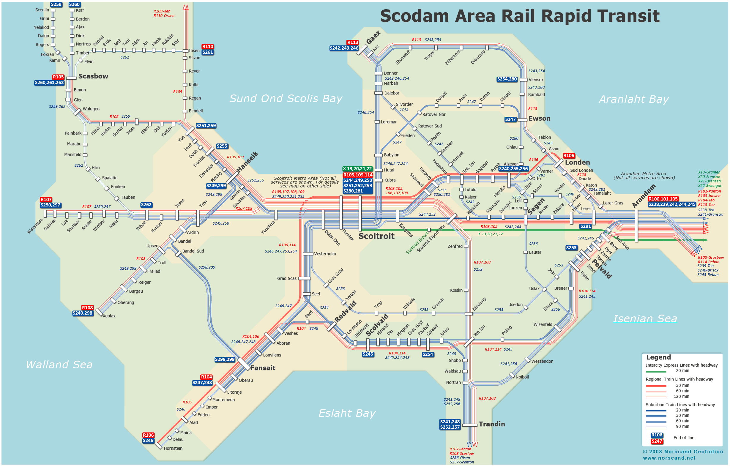
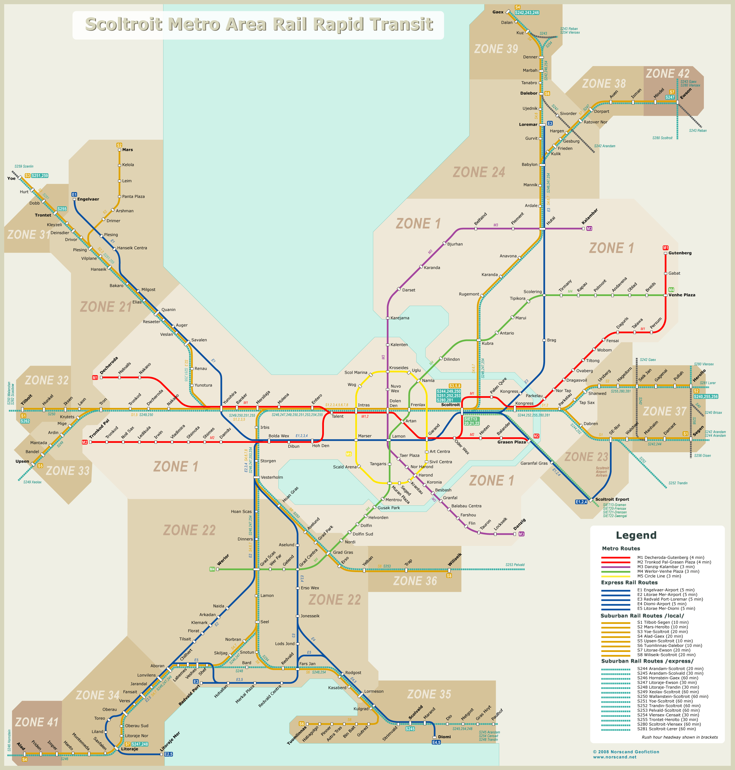
| Railways |
|
| Total length |
165km |
| High-Speed Lines |
0 km |
| Airports |
|
| Total |
1 |
| Sched.service |
1 |
| Seaports |
|
| Total |
3 |
| |
|
|
|