| |
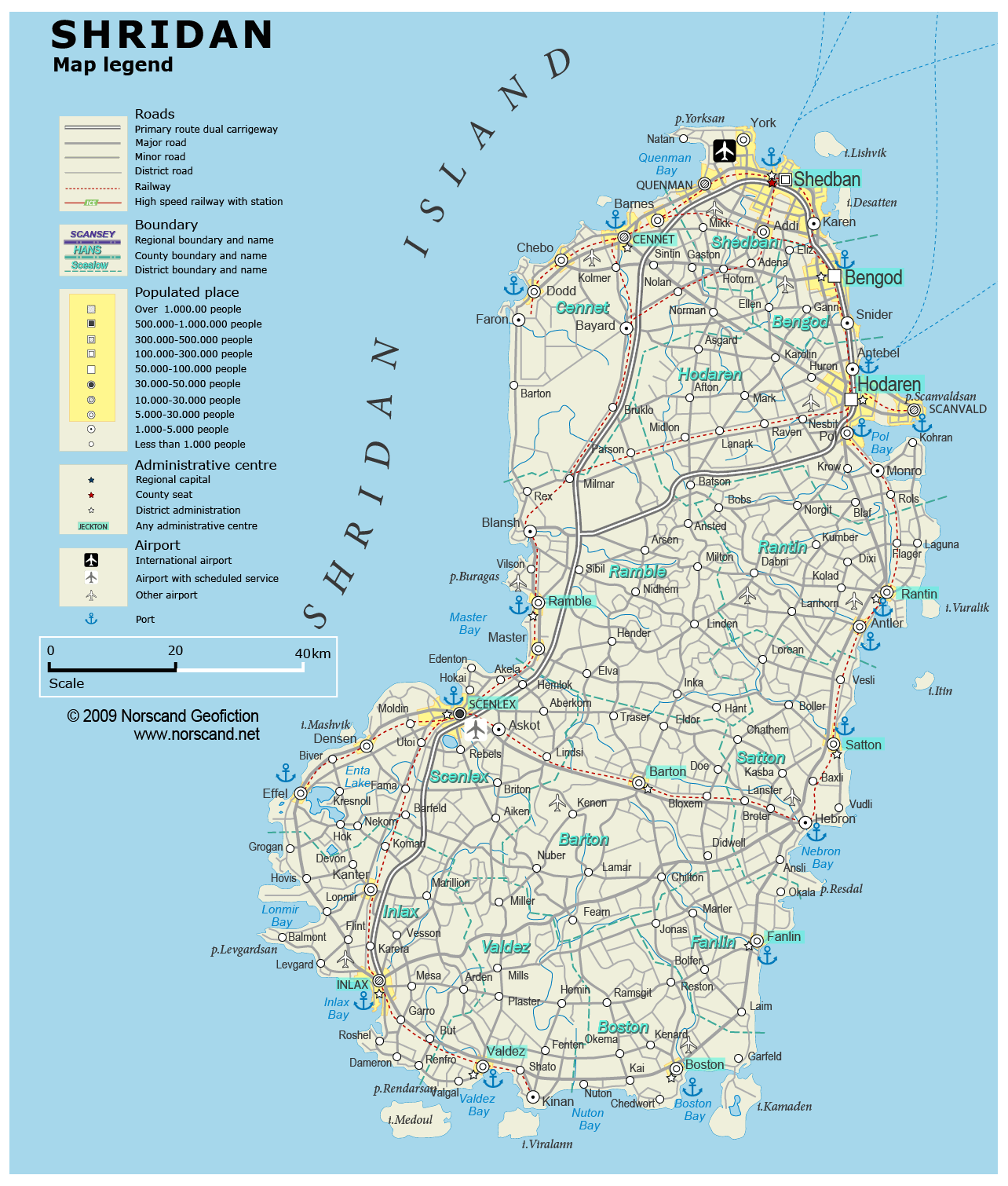
| General map (1284x1510, 0.27 mb) |
 |
| |
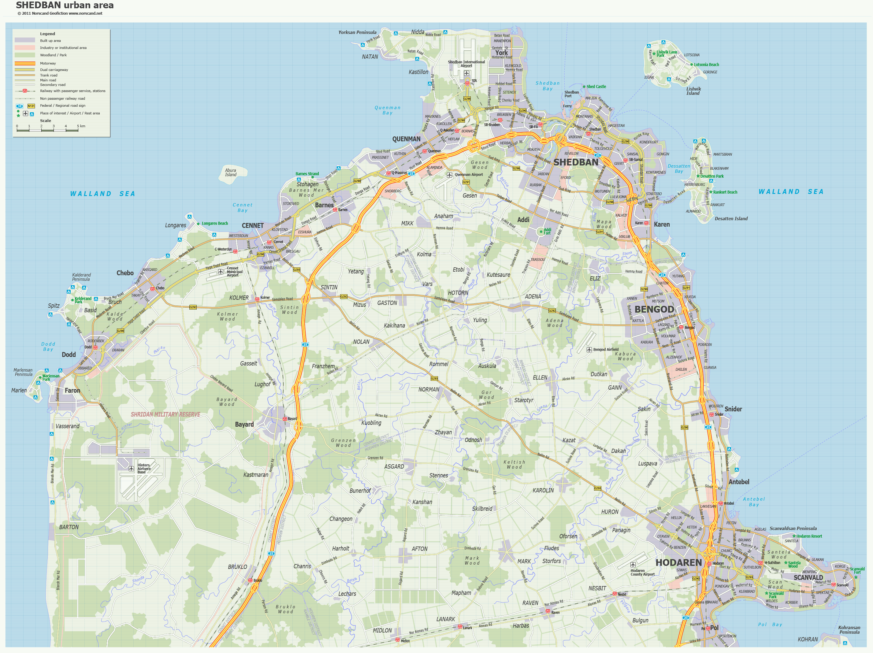
Shedban Urban Area Map
(2854x 2135 pix, 0.9 Mb)
|
 |
| |
|
|
| Flag |
Coat of Arms |
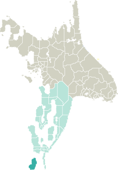
Location |
 |
 |
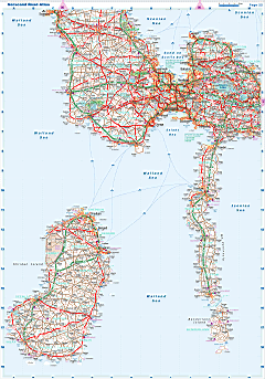
| Road maps for this area |
 |
|
| |
|
| Location |
Southern Garand |
| Area |
 Continental Continental |
0 sq.km |
| Isles |
9 620 sq.km |
| Water bodies |
25 sq.km |
| Total |
9 644 sq.km |
| Rank in Garand |
11 of 35 |
| Rank in Norscand |
42 of 103 |
| Size comparision |
X |
| Boundaries |
| Land |
0 km |
| Coastal (w/o isles) |
714 km |
| Population |
| Total |
639 917 |
| Rank in Garand |
17 of 35 |
| Rank in Norscand |
23 of 103 |
| 5 Largest towns |
| Shedban |
162 580 |
| Hodaren |
82 994 |
| Bengod |
56 088 |
| Scenlex |
40 404 |
| Scanvald |
19 176 |
| Administrative division |
| # of districts |
13 |
| County seat |
Shedban |
| Transportation |
| Roadways: |
|
| Total length (paved, basic network) |
5 703km |
| Expressways |
248km |
| Road density |
0,59 km/sq.km |
| Share of expw |
4% |
| Railways |
|
| Total length |
537km |
| High-Speed Lines |
0 km |
| Airports |
|
| Total |
14 |
| Sched.service |
2 |
| Seaports |
|
| Total |
18 |
| |
|
|
|