| |
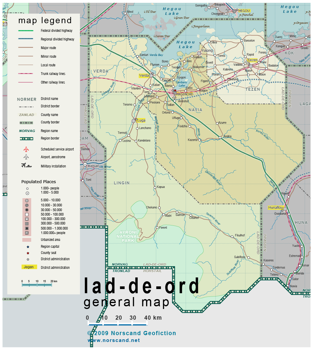
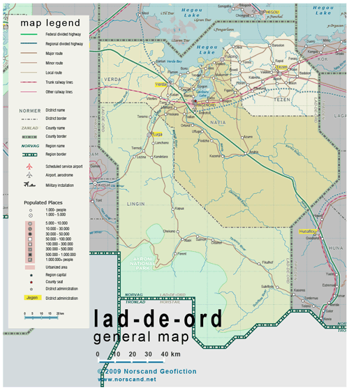
| General map (1052x1177, 433 kb) |
 |
|
|
| Flag |
Coat of Arms |
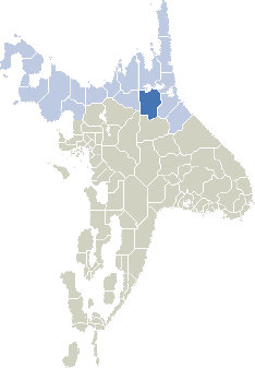
Location |
 |
 |
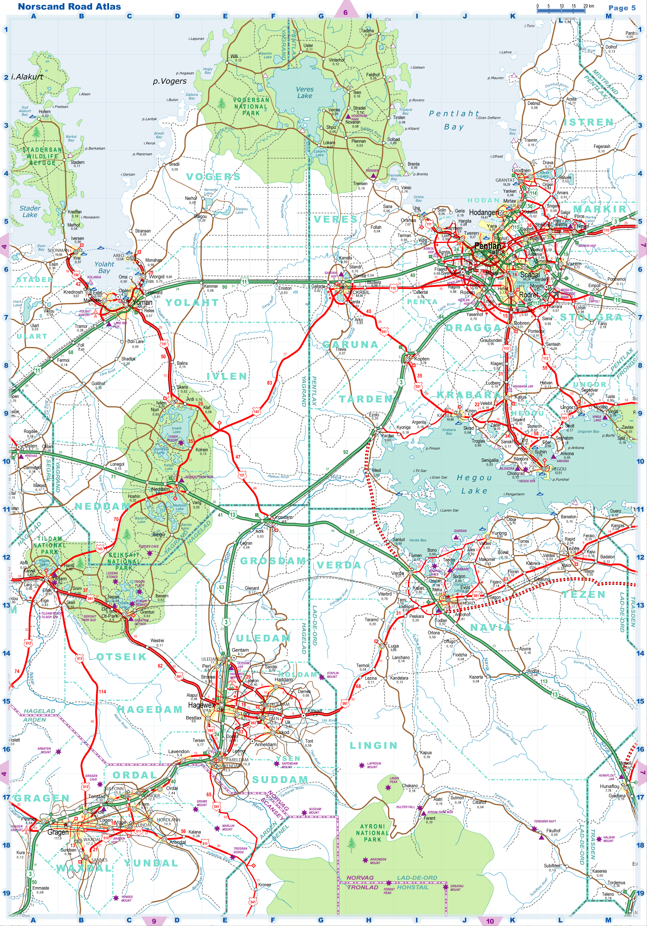
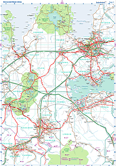
| Road maps for this area |
 |
| |
|
| Location |
Eastern Norvag |
| Area |
 Continental Continental |
19 710 sq.km |
| Isles |
0 sq.km |
| Water bodies |
1 609 sq.km |
| Total |
21 177 sq.km |
| Rank in Norvag |
3 of 17 |
| Rank in Norscand |
15 of 103 |
| Size comparision |
New Jersey |
| Boundaries |
| Land |
520 km |
| Coastal (w/o isles) |
0 km |
| Population |
| Total |
65 800 |
| Rank in Norvag |
17 of 17 |
| Rank in Norscand |
103 of 103 |
| 5 Largest towns |
| Hagenord |
17 700 |
| Luga |
9 800 |
| Tezen |
8 700 |
| Yurong |
8 300 |
| Verda |
6 500 |
| Administrative division |
| # of districts |
4 |
| County seat |
Hagenord |
| Transportation |
| Roadways: |
|
| Total length (paved, basic network) |
1200 km |
| Expressways |
165 km |
| Road density |
0.06 km/sq.km |
| Share of expw |
14 % |
| Railways |
|
| Total length |
160 km |
| High-Speed Lines |
0 km |
| Airports |
|
| Total |
2 |
| Sched.service |
0 |
| Seaports |
|
| Total |
0 |
| |
|
|
|