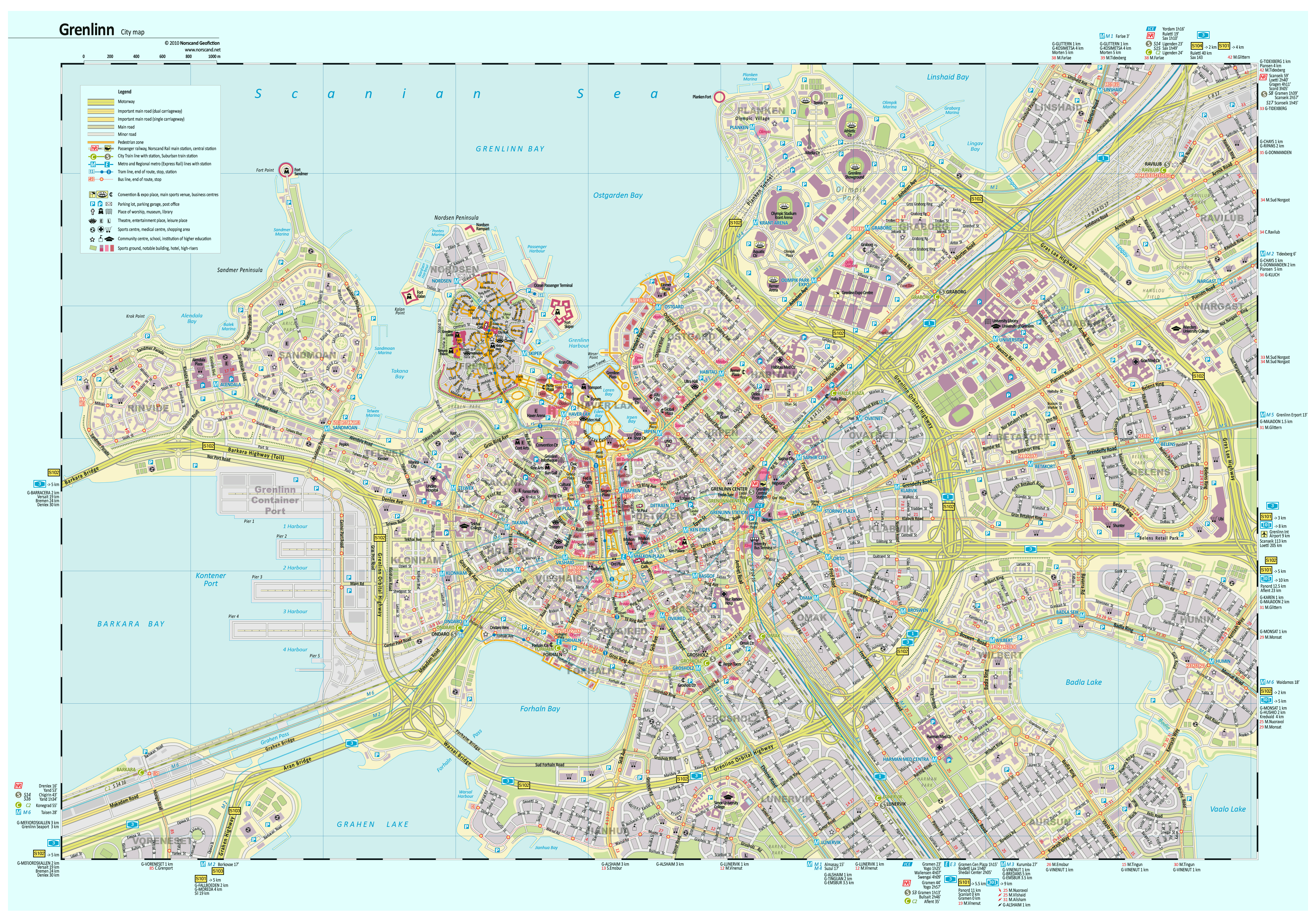
Grenlinn is the 4th largest city of Norscand (after Gramen, Scoltroit, Yordam). It has population of 830000 within city limits and 1250000 in metro area. Grenlinn has all the features of large city well developed central district, extensive and dense system of public transit, good road infrastructure. Thats why it was a challenge to me to draw the map of such complicated city.
I defined the map size smaller than Walden map in 4 times, because drawing huge map is very time consuming task. Decreasing size didnt affect the details, because the most interesting object are placed in central core and shown on the map.
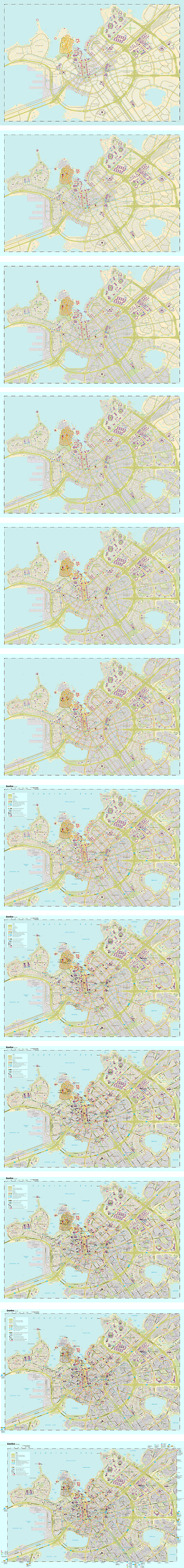
It took about a month to complete all work. Once I began to snapshot the state of map readiness. On the right you can see pictures how work progressed during the last 12 days before map is ready. Drawing secondary streets, outlining of buildings, inventing names and placing labels on map are the most labor-intensive work.
Grenlinn (translated as Greentown) was inspired by Tallinn, Sydney, London, Munchen, Beijing, Los Angeles. Find places reminding these cities! Map style was taken from GeoGraphic Pablishers I reckon they produce one of the best maps in the world. Grenlinn is attractive city for me and in the future I intent to return and draw the city core in more detail.
Its my first experience in making video of making map, enjoy!
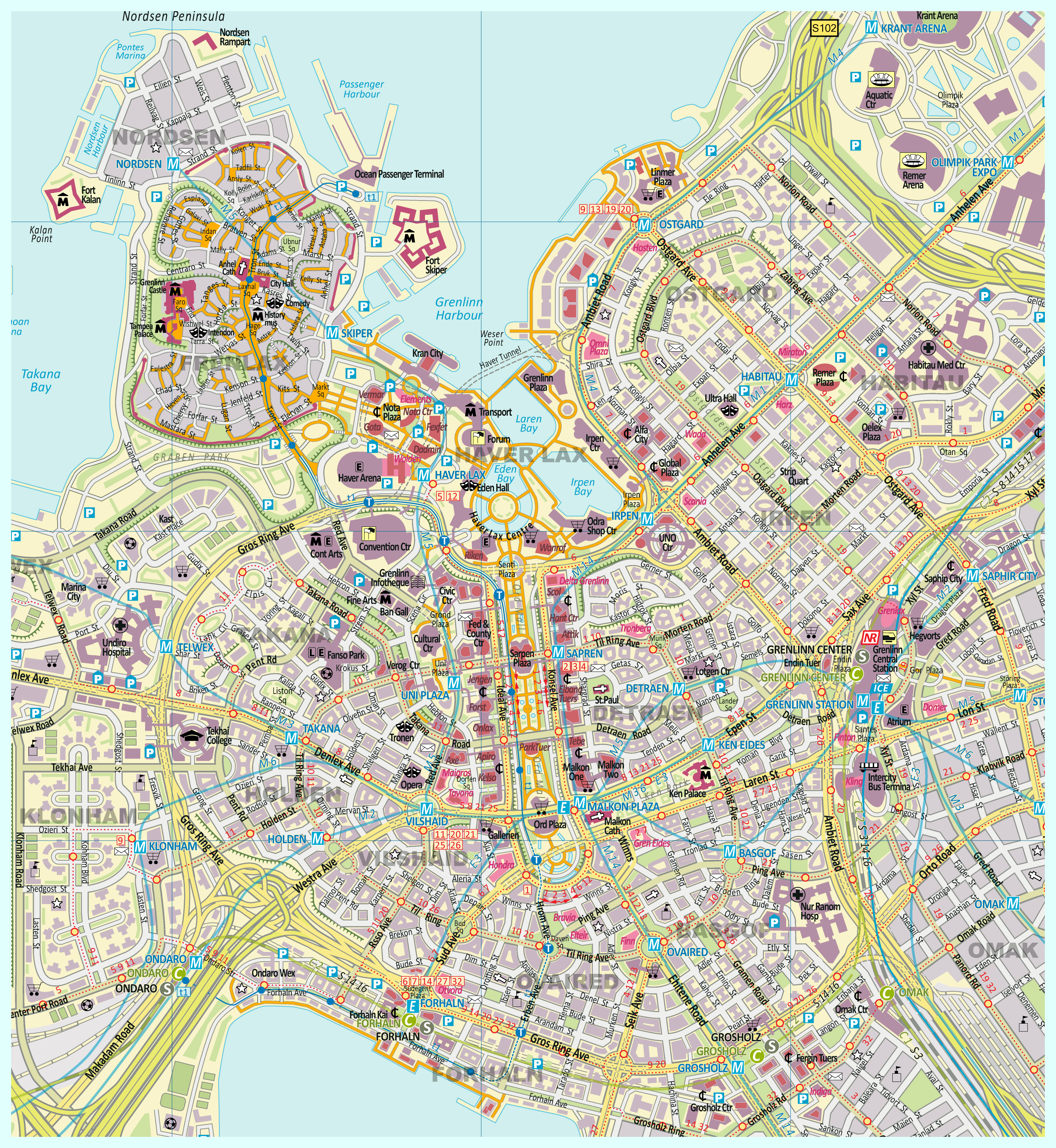
Central part of the map in size of double scale for close look.
Grenlinn City Map- double sized scale (2845x3092 pix, 1.4 Mb)
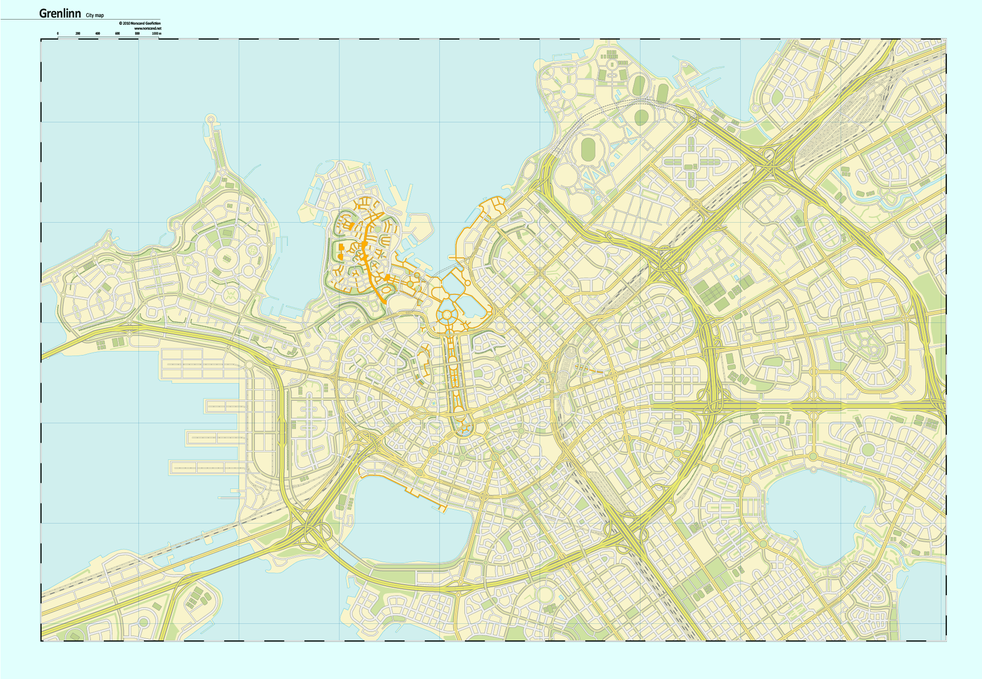
Road network without unnecessary details for future mapmakers
Grenlinn City Map- roads (1958x1354 pix, 0.6 Mb)
Map with public transit (metro, c-lines, bus, tram)
Grenlinn City Map - public transit (2486x1758 pix, 0.4 Mb)