| |
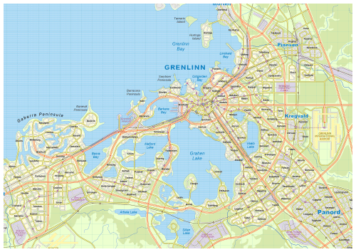
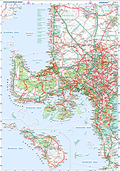
| General map (1371x565, 175 kb) |
 |
| |
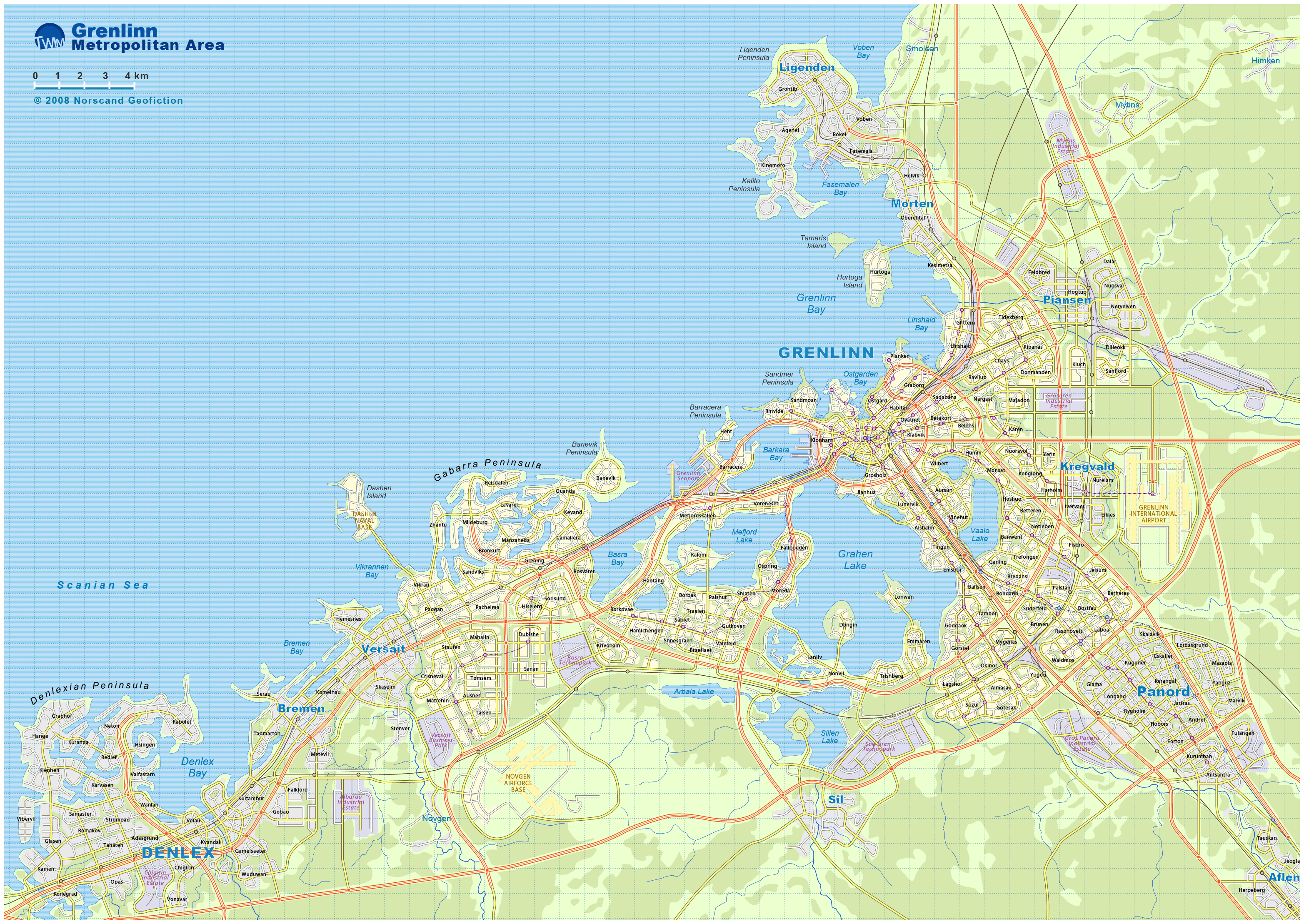
| Grenlinn metro area map(3130x2218 pix, 1.1 Mb) |
 |
| |
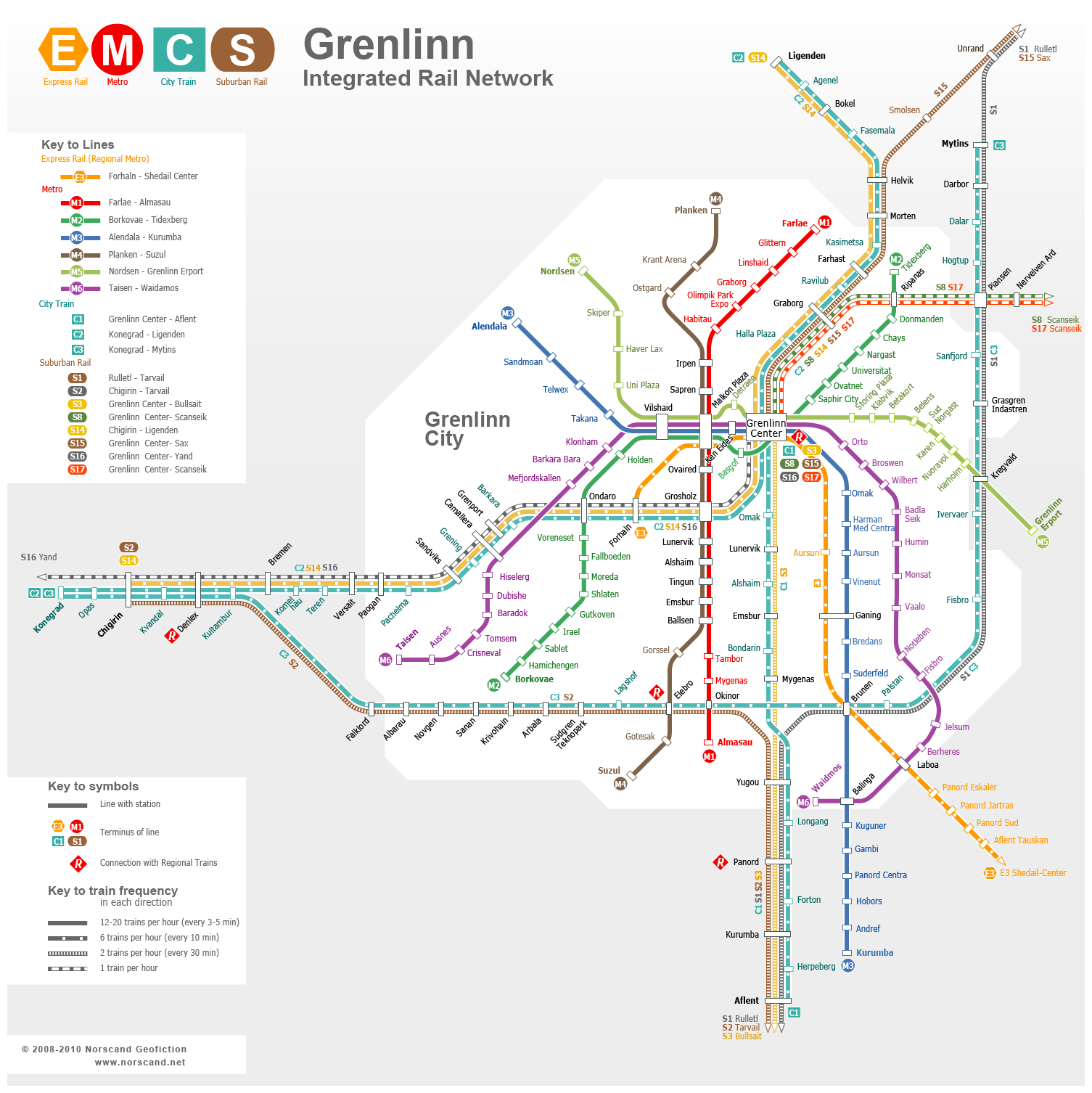
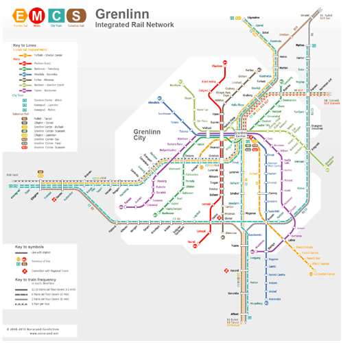
| Grenlinn Rail Rapid Transit Map(1505x1506 pix, 0.2 Mb) |
 |
| |
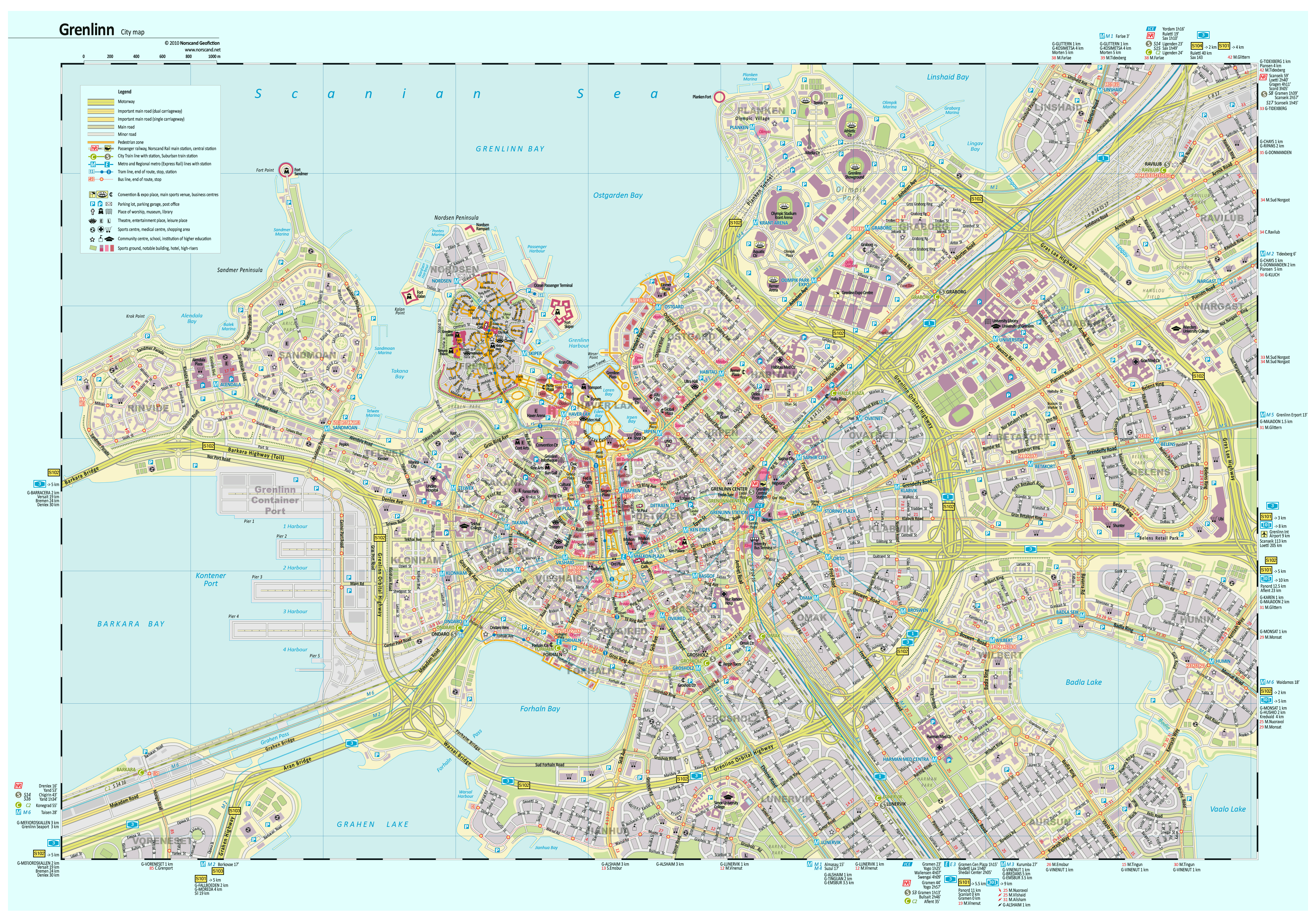
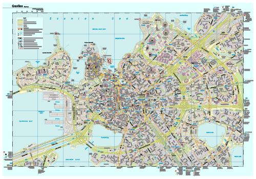
Grenlinn City Map(3972x2771 pix, 2.3 Mb)  Behind the map Behind the map |
 |
|
|
| Flag |
Coat of Arms |
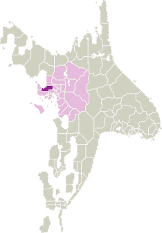
Location |
 |
 |
| Road maps for this area |
 |
| |
|
| Location |
Western Scansey |
| Area |
 Continental Continental |
4 078 sq.km |
| Isles |
9 sq.km |
| Water bodies |
3 sq.km |
| Total |
4 090 sq.km |
| Rank in Scansey |
14 of 24 |
| Rank in Norscand |
63 of 103 |
| Size comparision |
Rhode Island |
| Boundaries |
| Land |
250 km |
| Coastal (w/o isles) |
325 km |
| Population |
| Total |
1 260 000 |
| Rank in Scansey |
2 of 24 |
| Rank in Norscand |
5 of 103 |
| 5 Largest towns |
| Grenlinn |
831 182 |
| Denlex |
148 114 |
| Panord |
90 518 |
| Ligenden |
44 866 |
| Versait |
26 158 |
| Administrative division |
| # of districts |
3 |
| County seat |
Grenlinn |
| Transportation |
| Roadways: |
|
| Total length (paved, basic network) |
1 155 km |
| Expressways |
460 km |
| Road density |
0,28 km/sq.km |
| Share of expw |
40% |
| Railways |
|
| Total length |
330 km |
| High-Speed Lines |
55 km |
| Airports |
|
| Total |
1 |
| Sched.service |
1 |
| Seaports |
|
| Total |
5 |
| |
|
|
|